Keynote Speakers
Watch this space for all of our latest speaker announcements! Make sure to visit their blogs or websites, and also follow them on Twitter.
-
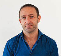
Daniele Quercia
Daniele Quercia is a computer scientist, has been named one of Fortune magazine's 2014 Data All-Stars, and spoke about "happy maps" at TED. He is interested in the relationship between online and offline worlds, and his work has been focusing in the area of urban informatics. His research received best paper awards from ACM Ubicomp 2014 and from AAAI ICWSM 2015, and an honorable mention from AAAI ICWSM 2013. He was Research Scientist at Yahoo Labs, a Horizon senior researcher at The Computer Laboratory of the University of Cambridge, and Postdoctoral Associate at the Massachusetts Institute of Technology. He received his PhD from UC London. His thesis was sponsored by Microsoft Research Cambridge and was nominated for BCS Best British PhD dissertation in Computer Science.
- Talk
- Speaking Session
- On the web
- http://researchswinger.org/
- On Twitter
- @danielequercia
- Talk
-
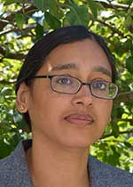
Sumeeta Srinivasan
Sumeeta is a lecturer of spatial analysis in the Department of Urban and Environmental Planning at Tufts University, Medford, MA, USA. Her research interests are at the intersection of sustainable development and spatial inequities of access in rapidly urbanizing areas in the world. Between 2006-2015 she was a Preceptor for Geospatial Methods at Harvard University, Cambridge MA, USA where she has taught courses on spatial models and GIS. She is affiliated with the Center for Geographic Analysis and the China Project at the School of Engineering and Applied Sciences at Harvard where she also was a postdoctoral fellow. The methodological lens that she uses in her research is spatial analysis: the use of GIS, remote sensing, statistical and spatio-temporal models. She has studied transportation, land use, energy use and infrastructure in cities in India, China and the US. She has a Ph.D. from the Department of Urban Studies and Planning at the Massachusetts Institute of Technology, Cambridge MA, USA in Transportation Planning
- Talk
- Speaking Session
- On the web
- Curriculum Vitae
- On Twitter
- @none
- Talk
-
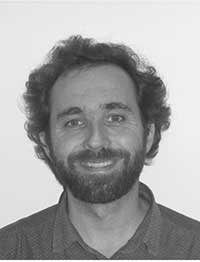
Alexandre Neto
Alexandre Neto has a degree in Survey Engineering by the Lisbon's Science Faculty and a master degree on Geographic Information Science and Systems by Lisbon Nova EMS. Currently, he's working at Direcçâo Geral de Recursos Naturais, Segurança e Serviços Marítimos, in the local implementation of the SNIMar project, the Portuguese Spatial Data Infrastructure for the Sea. Before, he worked at a cartography company called Turinta and, more recently, at Cascais Ambiente, a municipal environmental agency, where he worked in developing the municipal Green Infrastructure. In all cases, his work was always related to spatial analysis, spatial databases management, cartography and design. In 2011, he started to get interested by the Open Source Software trend and, step by step, started to address his everyday GIS tasks using exclusively Open Source Software. Since then, Alexandre Neto has become a impassioned Open Source advocate. He is a Charter member of the OSGeo Foundation, a founder member of the Portuguese QGIS User Group and the author of the open source dedicated blog "GIS Unchained".
- Talk
- Speaking Session
- On the web
- Curriculum
- On Twitter
- @none
- Talk
-
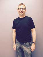
Steven Ramage
Steven is an accidental geographer. He's currently a Director at what3words, an advisor to Ordnance Survey and a Visiting Professor at the Institute for Future Cities at the University of Strathclyde in Glasgow, Scotland. In the past he's worked for Oceonics (Fugro), 1Spatial, Navteq (Nokia HERE), OGC and Ordnance Survey. He's a fellow of the Royal Geographical Society, a fellow of the Royal Institution of Chartered Surveyors and a member of the OGC Global Advisory Council. Until recently Steven also sat on the British Government's Independent Advisory Committee for the All Party Parliamentary Group for Smart Cities (representing national mapping interests). Steven will talk to us about problems related to unaddressed communities (like informal settlements), and the difficulties to communicate accurately locations where the formal addressing systems just doesn't work.
- Talk
- Speaking Session
- On the web
- what3words.com
- On Twitter
- @steven_ramage
- Talk
-
Rui Santos
Rui Santos has a degree in Geography and Regional Planning by Universidade Nova de Lisboa. Consultant and GeoMentor at Esri Portugal since 2001 responsible for the Education and Culture sector including research. Previously I had worked on different companies and projects including Lisboa2Baku, GEO-C (Geoinformatics – Enabling Open Cities), AgIM (Agricultural Information Management and Precision Farming), Projecto Nós Propomos (Project We Propose) Citizenship, sustainability and innovation in Geographic Education. SuGIK (Sustainable Geographic Information Knowlwdge Transfer for Postgraduate Education), 3D retrospective of the project Conquest of the Peaks in the World by Portuguese Climber João Garcia, ConTIG (Use of Geographical Information Technologies in Teaching/Learning), Census 2001, Cartography production including field work.
- Talk
- Career Development
- On the web
- blog
- On Twitter
- @ESRui
- Talk
-
Wolfgang Reinhardt
Prof. Dr.-Ing. Wolfgang Reinhardt is head of the chair for Geoinformatics and the AGIS research group within the faculty of Computer Science of the University of the Bundeswehr Muenchen (UniBwM). He teaches issues of Geographic Information Science, Spatial Information and Data Base Systems in the Bachelor and mainly the Master programs in Computer Science, Information Management and in Civil Engineering. He holds a Dipl.-Ing. (MSc) and a Dr.-Ing. (Ph.D) degree from the Technical University of Munich (1982, 1990). Before he was appointed as a full professor at UniBwM in 1997 he spent more than seven years in leading positions in the GI industry.
His research interests lie in various Geoinformation (GI) related issues like GI and Disaster Management, GI and sensors, Quality Management (data, processes, services) and GI architectures. He acted as project leader in more than 60 funded research projects (funds from European Union, German Ministry of research and education, German research council, German Military Geo Office, Several other Governmental and Industrial Organisations).
He published almost 200 scientific papers and frequently acts as member of scientific Committees of GI conferences and as reviewer for journals etc. In 2012 he was chair of the programme committee of the AGILE conference. He is a member of several professional organisations and working groups. He successfully supervised 12 PhD students. Currently seven candidates are working on a PhD topic under his guidance. Also he acted as expert in more than 10 accreditation and evaluation processes in Germany and central Europe.- Talk
- Career Development
- Short CV
- short cv
- On Twitter
- @none
- Talk
-
Marco Painho
Marco Octavio Trindade Painho is a Professor at the New University of Lisbon. He has published 31 articles in professional journals and 148 papers in proceedings of events, has 16 book chapters and published 11 books. His work also includes 143 items of technical production.
Participated in 2 events abroad and 4 in Portugal. Received 3 awards and / or honors. In his professional activities he has interacted with 195 employees in co-authorship of scientific papers.
Besides his teaching activities, Marco Painho was NOVA-IMS's Director (2000 - 2010), as well as the Coordinator of Master programme in Geographic Information Systems and Science via e-learning (2001 - 2008). He is the coordinator of the Master of Science in Geospatial Technologies (Erasmus Mundus).
Specializations: Geographical Information Systems and Science, Environmental Information Systems, Information Quality, Information Infrastructures, New Technology Implementation, GI Education, Distance Learning (e-learning).- Talk
- Career Development
- On the web
- CV
- On Twitter
- @painho
- Talk
